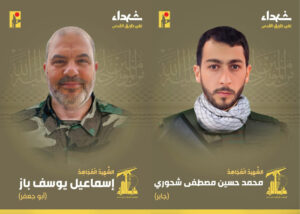
Background
In July 2020, after a long independent research work, we uncovered 28 sites related to the deployment of Hezbollah’s missile array in Beirut. The exposure gained worldwide publicity and many reactions that even led to the resignation of the city council members of the Town of Baabda, east of Beirut. Their resignation came in light of the lack of a response as to the veracity of our published report.
See the reports here:
On September 29, 2020, during his speech at the United Nations General Assembly, Israeli Prime Minister Benjamin Netanyahu unveiled three more sites related to Hezbollah’s missile deployment in Beirut.
Two of the mentioned locations are sites that we have already revealed in our comprehensive report from last July:
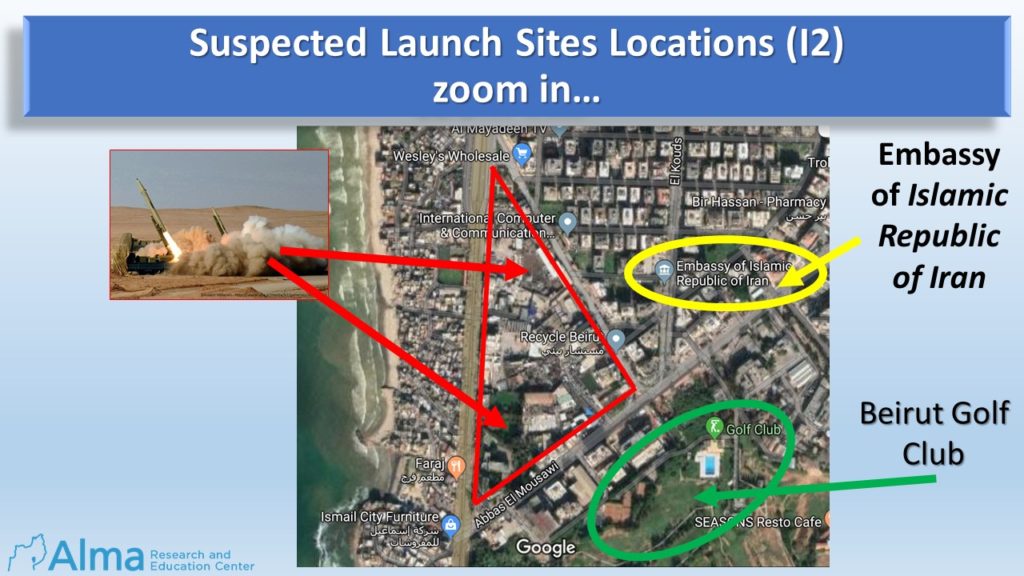
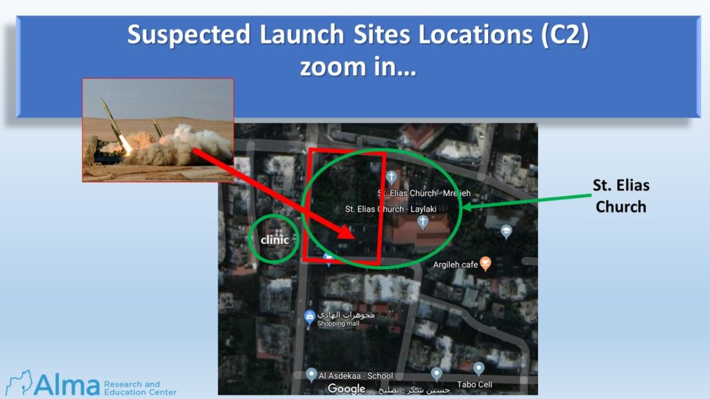
The Israeli Prime Minister’s exposure proved our working assumption as presented in our report: The launch sites are in close proximity to the missile production and storage sites, thus maintaining an immediate and instant launching capability.
After the publication of our report last July, we continued extracting intelligence collected and persisted on the extraction of new information.
In February 2021, our follow-up report was published which dealt with the School compounds of the Islamic Shiite Waqf Committee in Burj al Barajneh, which serve as a human shield for Hezbollah’s medium-range missile array in Beirut:
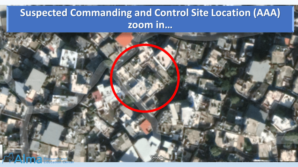
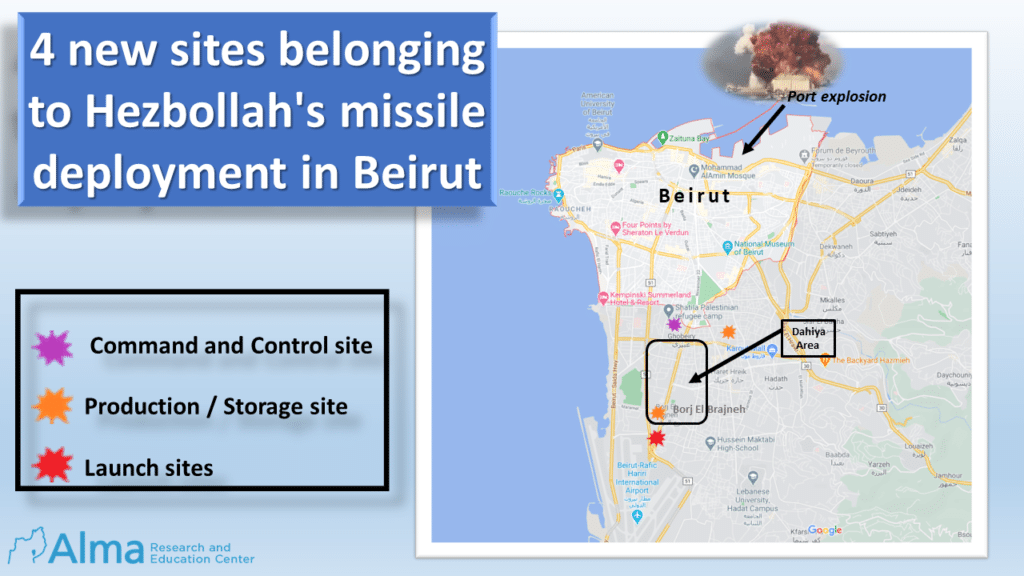
Our independent study on the deployment of Hezbollah’s missile array in Beirut has not come to an end. We were recently able to identify four new sites belonging to Hezbollah’s missile deployment in Beirut: a commanding and control site, two production and storage sites, and one launch site.
These four sites join the sites we unveiled in July 2020 and the sites we unveiled in February 2021.
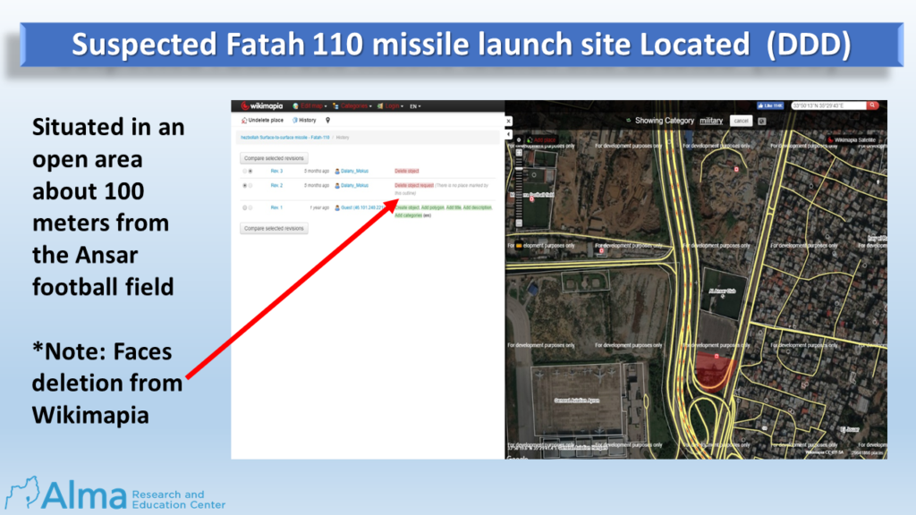
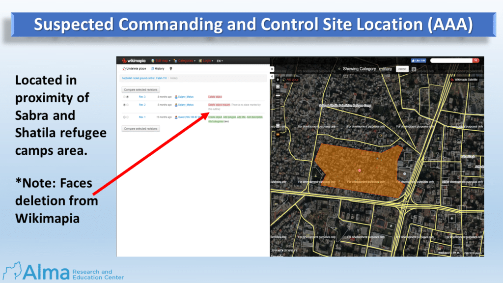
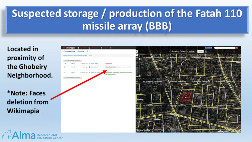
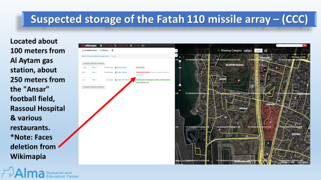
In the original July 2020 report mentioned above (on pages 10-11) you can find an explanation of the source of knowledge on which we relied ( Wikimapia online editable map) And for those who wish to delete this data.
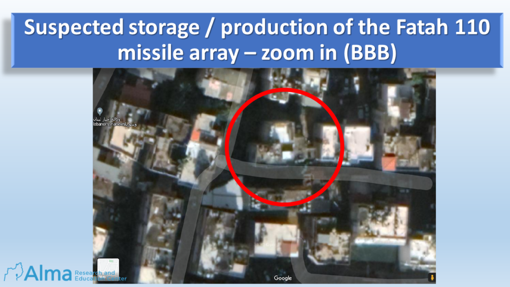
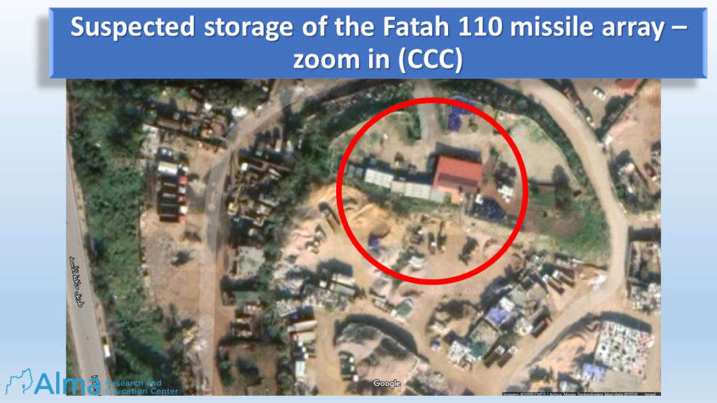
The marked sites on Wikimapia indicate an area with a number of buildings or a defined territory. After examining and analyzing the defined area, Alma Center analysts identified the polygon area and located the sites within it. A red circle on the “Zoom in” Aerial photo marks the sites positions.
The four new suspicious sites categorized by types and coordinates revealed in this special report:
| *Coordinates | Location purpose | Alma No. |
| 33°51’38’’N 35°30’2’’E | Commanding and control site | AAA |
| 33°51’39’’N 35°30’46’’E | Production /Storage site | BBB |
| 33°50’28’’N 35°29’45’’E | Storage site | CCC |
| 33°50’13’’N 35°29’43’’E | Launch site | DDD |
the “north” & “east” characters:
(example) 33°51’13’’N= 33°51’13 / 35°29’43’’E =35°29’43
Map of all locations:
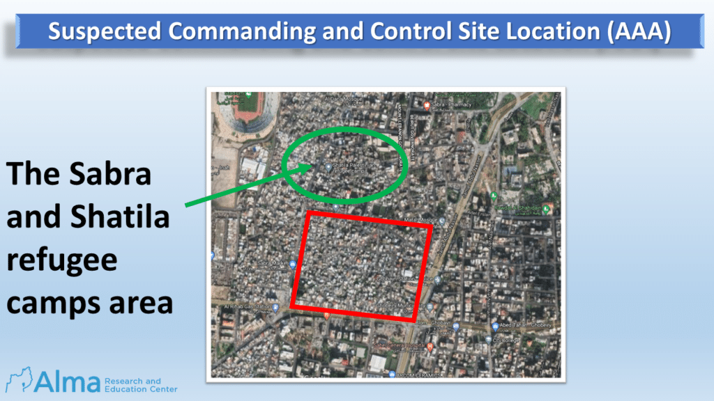
AAA. Property used to control and command the missile array:
- Coordinates: 33°51’38’’N 35°30’2’’E.
- Located in the proximity of Sabra and Shatila refugee camps.
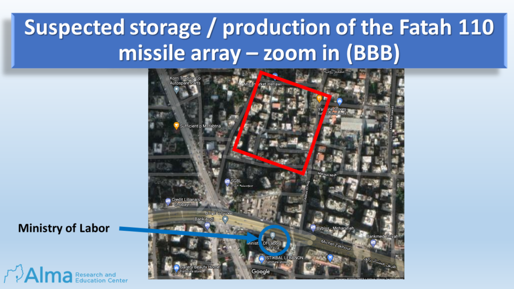
BBB. Property used for storage / production of the Fatah 110 missile array:
- Coordinates: 33°51’39’’N 35°30’46’’E.
- Located in proximity Ghobeiry neighborhood, near the Ministry of Labor building.
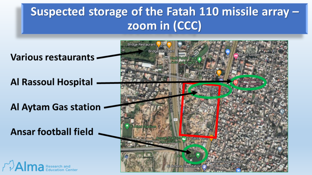
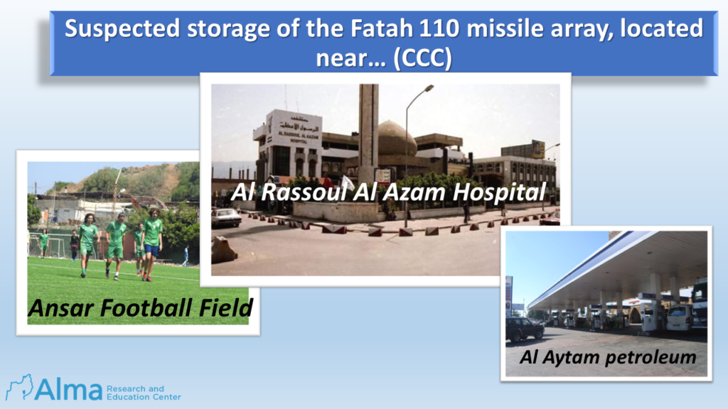
CCC. Property used for the storage of Fatah 110-missile array:
- Coordinates: 33°50’28’’N 35°29’45’’E.
- Located about 100 meters from a gas station, about 250 meters from the “Ansar” football field and various restaurants.
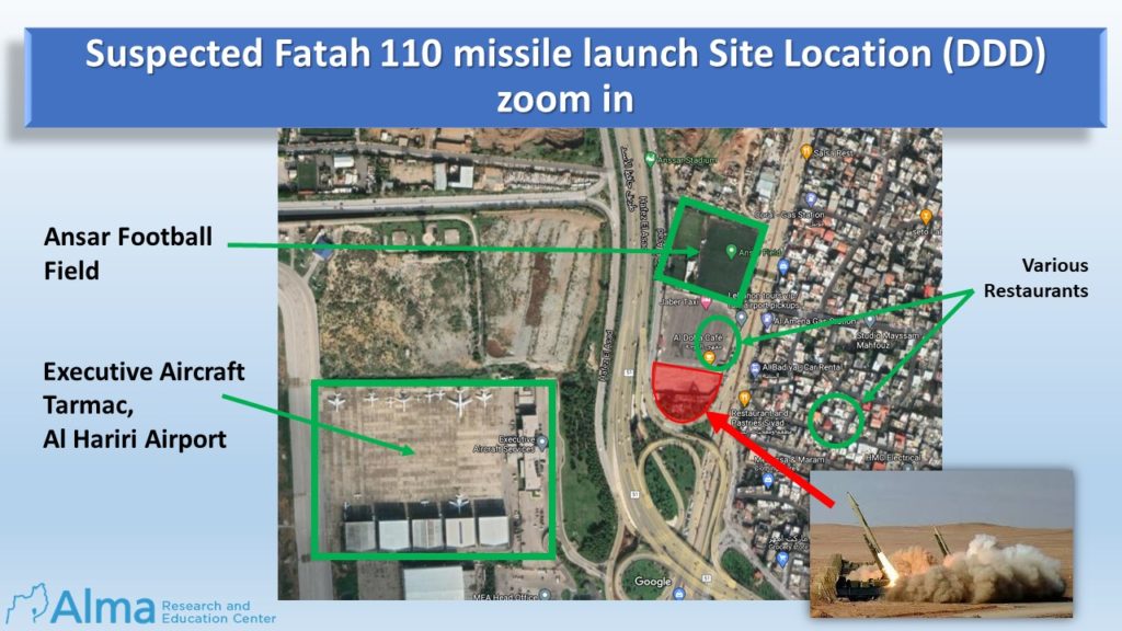
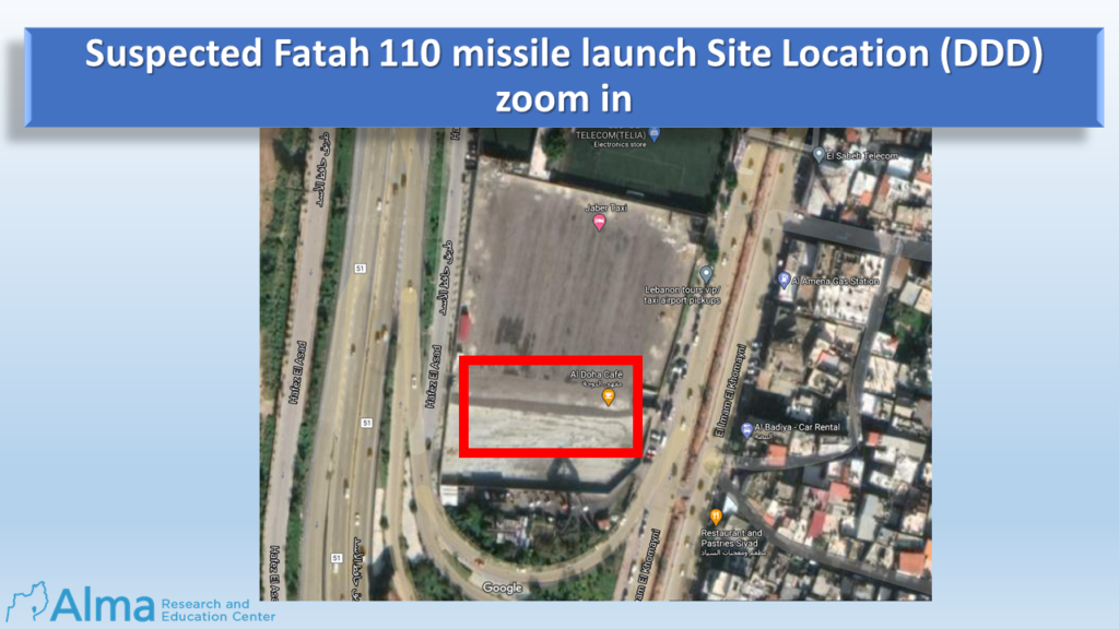
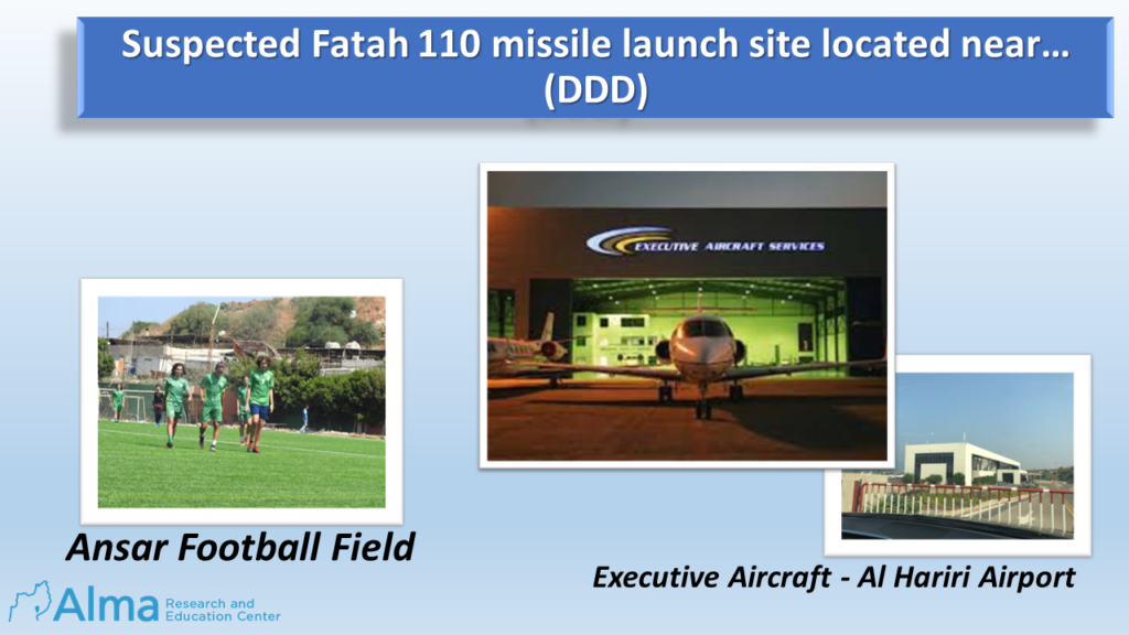
DDD. Suspected Fatah 110 missile launch Site Location:
- Coordinates: 33°50’13’’N 35°29’43’’E.
- Located in an open area about 100 meters from the Ansar football field, Al Amena Gas Station and an Executive Aircraft Tarmac adjacent to Hariri Intl. Airport.