
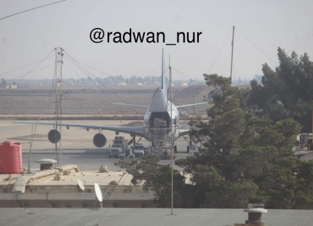
The Iranian corridor to Syria and Lebanon by land, air, and sea operates continuously. Sometimes it works at high intensity, and sometimes at low intensity. The operation of the Iranian corridor includes smuggling weapons to Syria and Lebanon and the infrastructure for producing and assembling advanced conventional weapons on Syrian soil. The precision missile project is a prime example of this.
As part of the Campaign Between Wars (CBW), attacks aim to thwart, disrupt, and delay the smuggling of weapons and the production infrastructure. It seems that the damage to the routes of the air and sea corridor is the most severe. However, Iran has not abandoned the land corridor, and the activity continues, primarily under civilian cover and human shield.
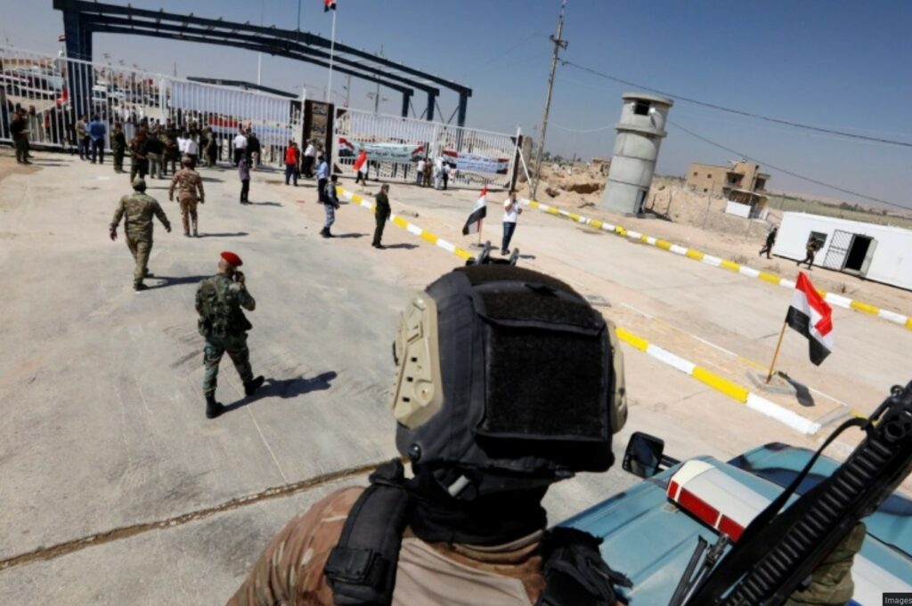
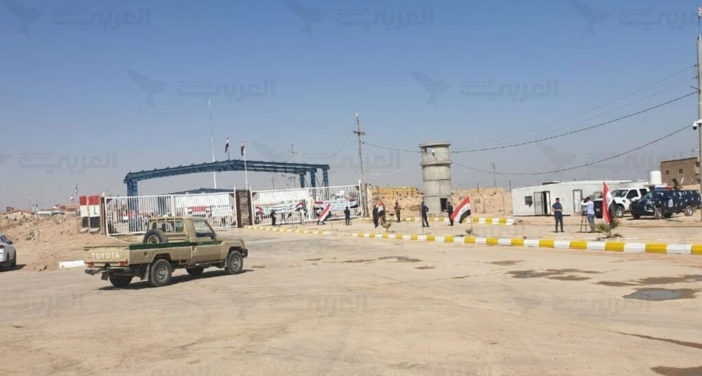
In light of the concentration of the offensive effort to disrupt the sea and air corridor that was described above, the Iranians returned to focus their efforts back on the “traditional” land corridor. Allowing them to utilize its advantages, namely, exploiting the fact that it is difficult to receive targeted intelligence on a single truck loaded with weapons along the land corridor in a desert area of 1800 km and compared to a plane or a ship, on which it is easier to receive targeted intelligence.
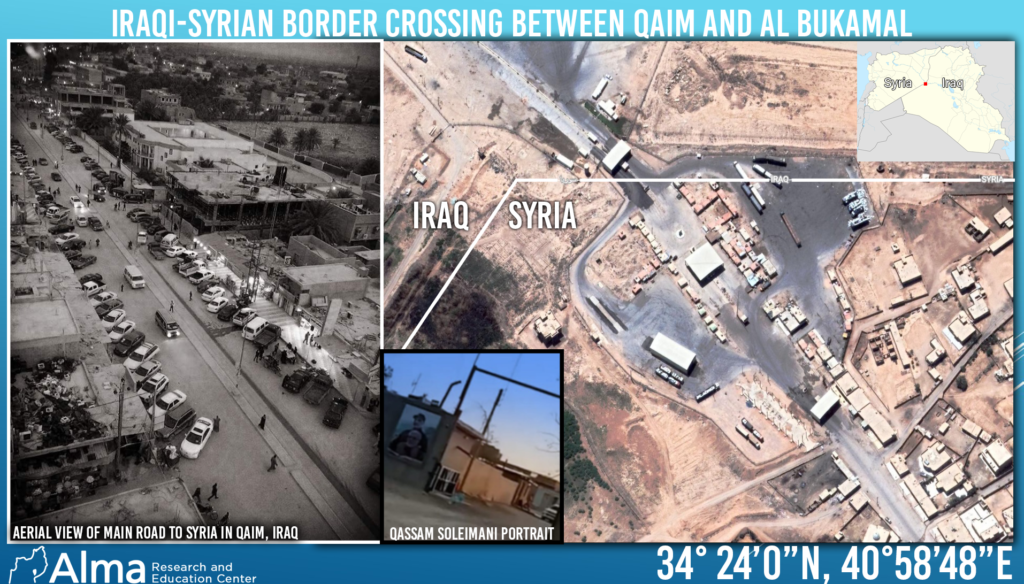
Based on open information, the current report’s purpose is to present in detail the existing land corridor routes from Iran through Iraq and Syria to Lebanon.
According to Israeli reports, there is a success of about 70 percent in impairing the transfer of weapons and of about 90 percent in damaging the weapons production infrastructure on Syrian soil. It is impossible to stop all the activity because of its enormous scope and the limitations of the available intelligence.
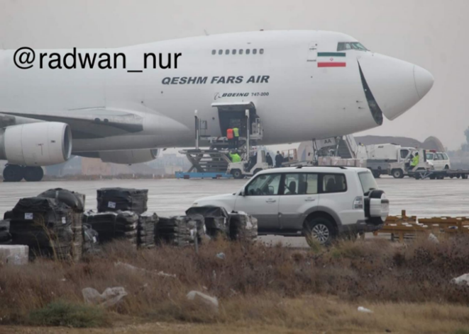
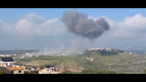
The last attack against the Iranian corridor in Syria was carried out on October 27 in the Damascus area and is part of a Sisyphean campaign. The more damage is done, the more the other side makes changes, finds alternatives, and rehabilitates infrastructures. In our assessment, the attack on the CERS 4000 institute in Masyaf on August 25 struck a fatal blow to the advanced weapons production infrastructure. However, as we have already published, the rehabilitation processes at the site, led by the IRGC, have already begun.
From an economic point of view, using the land corridor may make it easier for Iran to export goods to Europe while “laundering” them, if necessary, in Syria and Turkey, thus circumventing American and/or international sanctions.
From a religious point of view, the land corridor facilitates the transportation of Shi’ite pilgrims to Shi’ite holy sites in Syria. While also serving as an ideal civilian cover for the military activity and transfer of activists and weapons via the pilgrims’ transportation.
In our assessment, the American presence in al-Tanf severely restricts the Iranian activities within the land corridor and, as an operational constraint, directs them to one central geographical region in the Al-Bukamal and Deir ez-Zor area.
Is this also the case with northern Iraq and the transition to northeastern Syria? We are not sure of this. Despite the Kurds’ (hostile to the Shiite axis) control of this area and the limited American presence in this region, the Iranians might try to make use of this potential route since the Iranians are in a state of operational incapacity in the “comfortable” areas of the land corridor. As far as the Iranians are concerned, this would be an operational risk. The northern option is a surprising and unexpected route that will require precaution. Camouflage and deception can only succeed if the Iranians do not turn this route into a day-to-day routine.


One Response
Good and usefull Info.
Thank you
David