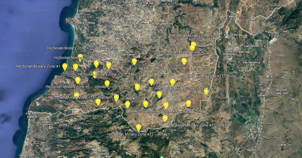
During the last year and a half, we have been mapping Hezbollah’s military zones in southern Lebanon. The areas are outside the villages and towns. So far, we have mapped 26 such military zones. The last of them is Wadi Saluki, which the IDF attacked on January 16, 2024.
Hezbollah uses dozens of such military sites in southern Lebanon. Entry to these areas is prohibited. Local citizens, UNIFIL forces, and even the Lebanese army are not allowed to enter or even approach these areas. Some of them are very close to towns and are even located near the Lebanese army and UNIFIL bases.
Hezbollah uses the military zones on a regular basis and in emergencies, for training, as weapons depots, deployment areas, defense areas, rocket and missile launch areas, etc.
The map below summarizes the intelligence picture known to us so far regarding the layout, location, and nature of Hezbollah’s 26 military territories in southern Lebanon. We continue to investigate and try to locate additional military areas, which will be updated on the map.
Please note that the map includes several layers that you can turn on or off for your convenience. The military zones are in yellow.