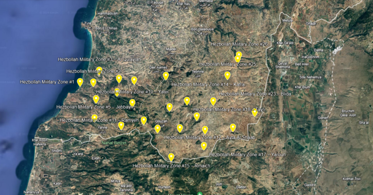
The Mapping of Hezbollah’s Military Areas in South Lebanon
During the last year and a half, we have been mapping Hezbollah’s military zones in southern Lebanon. The areas are outside the villages and towns.

During the last year and a half, we have been mapping Hezbollah’s military zones in southern Lebanon. The areas are outside the villages and towns.
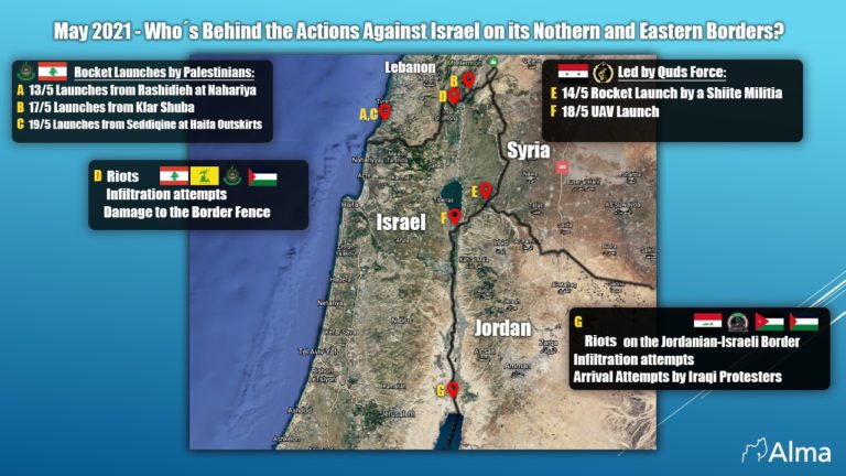
While everybody focused on the Gaza arena, the northern border and Israel’s neighbors from the north were also active.
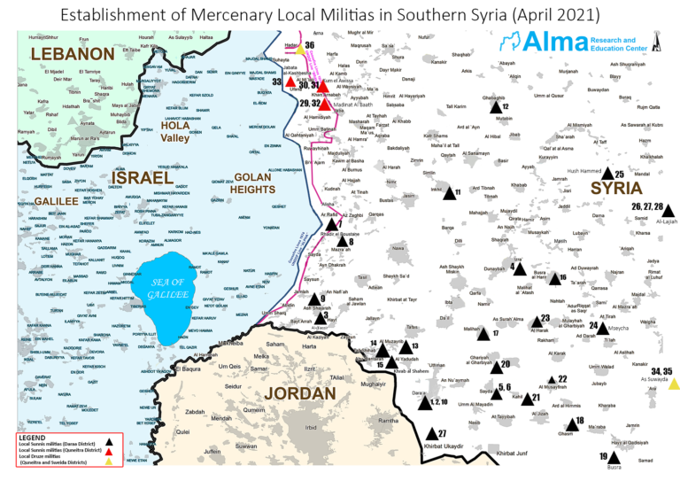
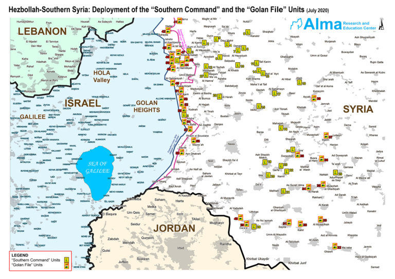
36 local militias in southern Syria consisting of locals, Sunnis (in the black and red triangles), and Druze (in the yellow triangles). The militiamen serve
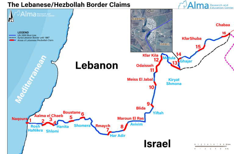
Map of the land-territory border dispute between Israel and Lebanon.
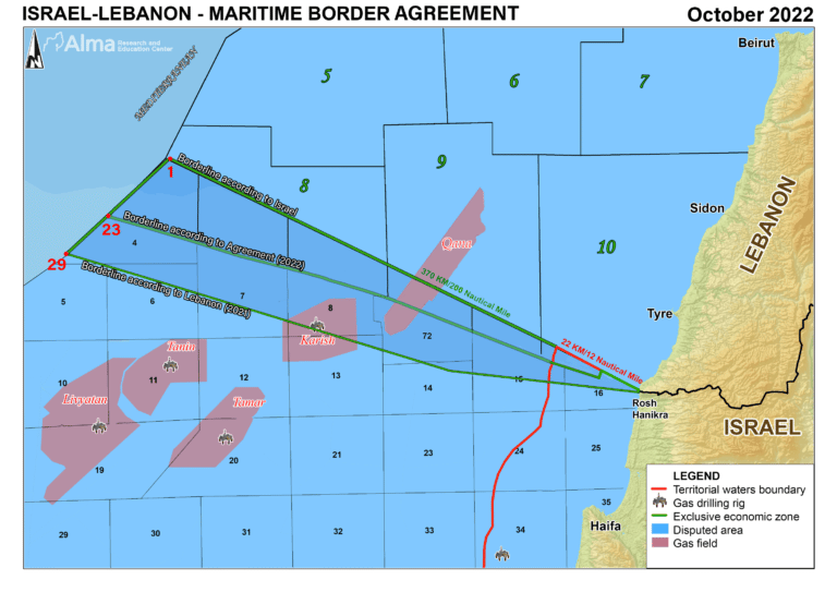
Updated September 2022.